.:[Double Click To][Close]:.
Get Paid To Promote, Get Paid To Popup, Get Paid Display Banner


Showing posts with label Street View. Show all posts

Wednesday, March 30, 2011

When in Rome: New Street View imagery of historic sites in Italy and France

[Cross-posted from the Official Google Blog]

We’ve been busy pedaling the Street View trike around the nooks and crannies of storied sites in Europe, including palaces, monuments and castles, so you can explore them in Google Maps with Street View.

Starting today, you can view some of the most historic and architecturally significant landmarks in Italy and France, including UNESCO sites in Rome, the center of Florence and stunning chateaux in the French countryside.

In addition to seeing the exterior of archaeological sites like the Imperial Forum and the Colosseum in Rome, you can now explore inside the Colosseum and imagine yourself viewing naumachiae—simulated sea battles for which the Colosseum was filled with water—or speaking with statesmen inside the Imperial Forum.

Inside the Colosseum, Rome

In few clicks you can navigate through centuries of history. Start at the birthplace of Rome, the Palatine Hill, where the mythical founders of the city, Romulus and Remus were found and saved by a she-wolf, and where the most ancient buildings of the city are located. Follow the Appian Way, a little path that became one of the most strategically important roads of ancient Rome. After the long walk, experience the splendor of Imperial Rome at the Thermae (Baths) of Diocletian—ancient wellness and cultural centers with 33 acres of pools, gymnasiums and public libraries.

Baths of Diocletian

After wandering around Rome, you can fast forward in time to witness the celebrated architectural wonders of the Italian Renaissance, including Giotto’s Campanile (bell tower) and Brunelleschi’s Cupola (dome) in Santa Maria del Fiore in Florence. While in Florence don’t miss the opportunity to walk through Ponte Vecchio and shop at the famous artisan jewel stores built on top of it!

Santa Maria del Fiore, Florence

In France, you can view picturesque chateaux and indulge your fantasies of living like French royalty by taking a virtual stroll around the beautiful Fontainebleau.

Château de Fontainebleau

Start exploring these sites in our Street View gallery, or find your favorite historic spots directly in Google Maps.

Posted by Marco Zennaro, Senior Software Engineer

Thursday, March 17, 2011

Take a festive tour for St. Patrick’s Day


People all over the world today are celebrating Saint Patrick’s Day in many different ways. You might walk in a local parade, spot a leprechaun, get pinched for not wearing green, bake some corned beef and cabbage, or even dare to drink a green pint.

For me, this holiday is not just about enjoying a feast with friends (even though I love baking the soda bread) – it’s also about going back to my Irish family heritage. Since Google Maps with Street View is available in Ireland, I went back to one of my favorite spots, Roundstone fishing village, that I visited two years ago. The winding, coastline roads are just as I remember them.

To get into the spirit, you can also play a Google Earth Tour to visit special places in Ireland and places around that world that celebrate this holiday. Fly to the Kilkenny Castle in 3D, see an exit ramp in the shape of a Shamrock, and visit an Irish village. We’ve also added the tour to the Google Earth Gallery so you can download the file and explore on your own.

Every year, the Chicago river turns green for the St. Patrick’s Day Parade

For this Irish celebration, you can also add your own 3D buildings to Google Earth. With Google Building Maker, find your spot in Dublin, Ireland and quickly model a building using our photos. Or, try your hand at SketchUp and add your own creations to Google Earth anywhere in the world (buildings above were created by users).


So now we’ve given you plenty of ideas on how to celebrate this Irish holiday. Happy St. Patrick’s Day!

Monday, March 14, 2011

A Street View showcase


Since Street View first launched in Google Maps, it’s grown from five U.S. cities to locations on all seven continents, and we’ve been able to visit some beautiful and historic places around the world. To share some of our favorite imagery with you, and also give you a behind-the-scenes look at Street View technology, we’ve updated our Street View site.

Site homepage, featuring Kirstenbosch National Botanical Garden, Cape Town, South Africa

In addition to the places on the site homepage, we’ve included highlights from around the world in a gallery that lets you see ski slopes, UNESCO World Heritage sites, and breathtaking places on all seven continents.

Street View gallery, featuring Old Town of Segovia and Its Aqueduct

While we’ve been able to photograph most places in Street View with our cars, plenty of unique and interesting locations around the world aren’t accessible by car. To help us visit places with smaller paths or unpaved terrain, we’ve developed the Trike, Snowmobile and Trolley, which have enabled us to share parks, ski trails, and even museums with you in Street View. You can now check out pictures and 3D models, and learn more about all of these platforms on the site.
Once we collect new imagery, we “stitch” the individual photographs into the 360-degree imagery you see in Google Maps. The revamped site provides an in-depth look at this process and shows the progression of photos into the immersive Street View experience.

You can also learn about how to use Street View, meet our friendly mascot Pegman, read about our cutting-edge face and license plate blurring technology, or see where Street View is available across the world.

We’re starting with this update for our United States site, and will continue rolling it out for more countries in the coming months. Start exploring new places at maps.google.com/streetview.

Posted by Katie Mandel, Product Marketing Manager, Google Maps

Baseline to baseline, we’ve got the basketball games covered

[Cross-posted from the Official Google Blog]

Do you hear the dribble on the court and the chanting of the fans? Following an action-packed week of buzzer beaters, the 2011 NCAA® Championship here in the U.S. promises to be as exciting as ever.

As a college hoops fan, I often wish I could experience the games sitting in the arenas—and I’m sure I’m not alone. This year, our college basketball tournament map lets you get as close as you can to the games without leaving your desk thanks to 3D models of the tournament’s 14 arenas. Take a virtual tour of the venues by watching the video below, or download this tour and open it in Google Earth.


Plus, we’ve created a special page for you to keep track of all the excitement during the next few weeks. You can see an up-to-date tournament schedule, explore the college campuses in Street View and click through to watch the actual games on NCAA® March Madness on Demand®. You can also create a bracket using Google Docs, read Google News articles on the games and download basketball apps from the Chrome Web Store. It’s all here (along with a fun surprise) at www.google.com/collegebasketball2011.

And since there’s been a long-running debate over whether teams playing closer to their home court have an advantage, we added a “Distance Tool” on the map to make it easier to measure how far schools have to travel from game to game. We’ll see how things play out, but the defending champion Duke Blue Devils may have to travel more than 2,000 miles to Anaheim if they win their first two games.


As my friends always say when we can’t wait for the tournament to begin, “Send it in, Jerome!” May your favorite school reach the finals and we hope you enjoy all the basketball fun at www.google.com/collegebasketball2011.

Thursday, March 10, 2011

Visit the Hiroshima Peace Memorial in Street View


We’ve added many historic sites to Street View to let you explore these places online, and now we’ve included Street View imagery of the Hiroshima Peace Memorial,  also known as the “Atomic Bomb Dome.” On August 6, 1945 at 8:15am, the first nuclear device to be used in warfare exploded almost directly above this building. The annihilated structure became an iconic symbol of the bomb’s devastation, and despite rebuilding the rest of the city, Hiroshima decided to keep the Dome in its post-war condition to stand as a living testament to the horror of nuclear conflict.


The Atomic Dome has always been an important reminder of history, but also a living beacon for the message of global peace. The desire to experience the Peace Memorial as a physical space makes it a great match for Street View, which both enables people around the world to tour the site virtually and also preserves this important imagery for the next generation. We hope that the imagery will inspire users outside of Japan take a new interest in Hiroshima’s history and think deeply about the importance and meaning of peace.

Along with this Atomic Dome imagery, we have also added special collections of seven places in Hiroshima Prefecture, including Hiroshima Peace Memorial Park and the “floating” Itsukushima Shrine at both high and low tide.

Posted by Setsuto Murai, Strategic Partner Development Manager

Monday, February 28, 2011

Pedaling to new places with Street View


Street View enables you to visit places around the world virtually, from the scenic Champs-Elysées in Paris to bustling Times Square in New York City. We’re able to collect imagery of most of these places with a car, but when we find an interesting place that a car can't reach, we get more creative.

In 2009 we introduced the Trike, a modified bicycle outfitted with Street View equipment, to visit these locations, from towering castles to picturesque gardens. The Trike team has been pedaling around the world, and today we’ve added more of these unique places to Street View in Google Maps.


With the Trike we’re able to take you inside the grounds of historic locations like the Château de Chenonceaux in Civray-de-Touraine, France.


In addition to historic sites, you can also view beautiful outdoor scenery of places like the National Botanic Gardens in Dublin.


You can now see 360-degree panoramic images of these gardens at the San Diego Art Institute, as well as several other gorgeous spots in Balboa Park in San Diego, California.


To continue exploring these and other beautiful and historic places around the world, we encourage you to visit Street View in Google Maps. If you are the owner of a private property and would to make your location available for users to explore in Street View, please visit this site to learn about our partner program.

Tuesday, February 1, 2011

Street View takes you inside museums around the world


We’re always excited to share new Street View imagery with users, whether a botanical garden in South Africa or ski slopes in Canada. While Street View has enabled users to visit places all around the world virtually, the demand to show a broader range of popular locations has been great. Today we’re entering new territory with our experiment to take Street View technology indoors.

The Art Project, developed by a group of art-loving Googlers, is a collaboration between Google and 17 of the world’s most acclaimed museums. Select works of art chosen by these partners are now available for you to explore through Street View in Google Maps, and the Art Project site offers an immersive experience to explore museum information, floor plans, more than 1000 high-resolution pieces, and Street View imagery. Learn more about the Art Project on the Official Google Blog.

To take you inside magnificent spaces like the State Hermitage Museum in St. Petersburg, Russia, our team needed to update the way we go about gathering Street View images.

The State Hermitage Museum, St. Petersburg, Russia

Street View imagery is typically collected using cars and we’re able to utilize the ample roof space and interior storage of these vehicles for all of our equipment. To take Street View technology indoors, we needed to fit all of the equipment on a much smaller vehicle, a push-cart lovingly dubbed Trolley.

Pictured with Trolley: Daniel Ratner, Mechanical Engineer and Matt Williams, Program Manager at the Van Gogh Museum in Amsterdam, The Netherlands

Trolley is outfitted with a few components that are key to collecting indoor imagery: a panoramic camera to collect 360-degree views, lasers to capture distances to walls, motion sensors to track Trolley’s position, a hard drive to store data, and a laptop to operate the system.

With this adapted equipment, we were able to gather the imagery and bring it into Google Maps, and you can now drag Pegman directly onto museums like the Metropolitan Museum of Art in New York City to explore their impressive European Paintings wing.

The Metropolitan Museum of Art, New York, United States

You can also enter museums when you’re already looking at Street View imagery of the museum exterior. You’ll notice new double-arrow navigation links from the nearby streets leading you inside, as you can see here for the Palace of Versailles.

Palace of Versailles, Versailles, France

Once inside the museum, you can navigate around rooms freely with the navigation arrows or simply click on a distant spot to jump to a closer view. Movement between floors can also be done with ease by selecting a different level from the new control panel below the Street View compass and zoom controls.

Alte Nationalgalerie, Berlin, Germany

We’re excited to introduce this new imagery in Street View, and will continue to improve and develop this indoor experience. To explore these museums directly through Street View in Google Maps, visit maps.google.com/museums, and to view high-resolution artwork and learn more about the museums, check out the Art Project at www.googleartproject.com.

Posted by Jonathan Siegel, Software Engineer

Wednesday, December 8, 2010

Street View in Romania


Bram Stoker’s world famous novel Dracula was believed to have been inspired by fifteenth century Wallachian Prince, Vlad Dracul from Romania (better known to many as Vlad the Impaler). The legend of the vampire is still deeply rooted in Transylvanian culture today, and tourists from across the world come to explore the history and mystery of the many beautiful castles that can be found here.

But of course those aren’t all the sights Romania has to offer, and now you can see for yourself, because today we’re making 360-degree Street View imagery available in Romania for several cities and roads.

From your virtual vantage point, you can now take a look over the bridge onto Lacul Vidraru (Vidraru Lake). This is the starting point of the most beautiful road in Romania, the Transfăgărășan mountain pass, which at its highest point reaches 2,034 meters above sea level:


Or check out the summer residence of Romanian Kings, Castelul Peleș (Peleș Castle):


It’s not just Paris that has an Arc de Triomphe. You can whizz round the Romanian
Arcul de Triumf in the capital Bucharest:


And here’s our parliamentary palace, Palatul Parlamentului (Parliament Palace):


There’s heaps to explore but I’ll leave you with one final tip, and that’s to visit
Vatra Ardealului, my favorite cofee shop in Brasov, which you can see below:


Welcome to Romania and enjoy your virtual exploration!

Posted by Octavian Iercan, Operations Lead, Street View Europe

Tuesday, November 30, 2010

A whole new world of Street View


Google Earth has always enabled you virtually fly around the world from the comfort of your home, but there are a lot of great places to explore on the ground as well. So when we sat down to enhance the Street View experience for version 6, we focused on improving not only how you fly around but also how you land and explore the world at street level. Although Street View is technically a big collection of photos, we want you to feel like you’re actually walking down the street instead of jumping from photo to photo. Today, we’re proud to show off this concept in the new version of Street View in Google Earth 6.


To do this, we took the ideas that were developed for Smart Navigation in Google Maps and pushed them even further. Using the panoramic images and 3D depth data from our Street View vehicles, we built 3D street scenes and integrated them into Google Earth. As you move along the street, we blend together different panoramas to create the illusion of one continuous 3D scene.

To help you navigate, we’ve also added new controls for ground-level viewing: use the scroll-wheel to move forward and backward, double-click to move towards a point, and click-and-drag to look around. Since we don’t have images for every viewpoint in the world, moving away from the spot where a photo was taken can look weird at times. So using the double-click and scroll wheel features will navigate you to the clearest view. For the more adventurous, the keyboard arrows also enable you move freely through the environment but with some distortion.

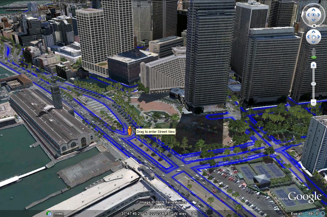
Because Street View is now fully integrated into Google Earth, your place in Street View matches your location in 3D. This means that you can easily see 3D buildings, terrain, and now 3D trees by toggling from Street View to ground-level view — simply click on the building icon in the navigation controls. Take a look at these two different images of the same location, one in Street View and one in ground-level view.


The easiest way to enter the new Street View experience is by grabbing the Pegman from the navigation controls, and dropping him wherever there is a blue highlighted road. You can also enter Street View by zooming in close to the ground. And of course, you can exit at any time by clicking on the “Exit” button.

So head out and explore the world from the streets! Here’s a tutorial video to demonstrate how to use the new Street View in Google Earth 6:


Posted by Greg Coombe, Google Earth Engineer

Monday, November 22, 2010

Even smarter Street View navigation: single click to go (anywhere!)

Last year we introduced Smart Navigation to Street View, which allowed you to jump to a new panorama just by double-clicking on a place or object. Now you can quickly navigate to those images with just a single click.

For those of you who haven’t used this click-to-go feature before, notice that as you move your mouse around in a street view panorama, a disk or rectangle follows the cursor (what we call the “pancake”). This pancake not only makes the panorama feel three-dimensional, but shows you where you can jump to a new panorama to get a different view. For instance, let’s say you’re checking out the town of San Miguel de Allende in Mexico because you read about the large community of artists and writers living there. You can get a closer look at the Parish of San Miguel by clicking on the pancake and navigating around the church.


A few more clicks will take you through the colorful neighboring streets. Through your virtual exploration, you can see a restaurant in the distance behind the below rectangular pancake:


With a single click on the pancake, you’re transported right in front of that location and the pancake reappears - this time with a magnifying glass. This means you can zoom in to get an even closer view:


To read the menu at “El Infierno” and see what kind of food they may have, the single click to zoom also applies here. We’ve also made it easier to zoom out. Once you’ve zoomed in all the way, the magnifying glass changes from a plus sign to a minus sign, signifying that the next click will zoom all the way out.


QUE VIVA single click navigation!

Posted by Daniel Filip, Senior Staff Engineer

Thursday, November 18, 2010
Street View comes to 20 German cities


Two weeks ago, we celebrated with the people of Oberstaufen when we made available the first ever images for Street View in Germany. Today I’m pleased to let you know that you can explore even more of Germany because we’ve just released 360-degree, street level imagery of Germany’s 20 largest cities, including Berlin, Hamburg, my home town of Munich and more.
If you haven’t yet been to Germany, or if you simply want to refresh your memory from a previous visit, here are some places that might be fun to explore. These panoramic images that virtually transport you without the hassle of a plane ticket are now accessible directly from Google Maps.

Okay, I know it’s obvious, but the Brandenburg Gate in Berlin is one of Europe’s most iconic monuments:


For a complete change of scenery, check out this traditional German architecture, near Hamburg’s historic port in Speicherstadt:


And here’s a personal recommendation for a place where I spend a lot of time and is a good example of a traditional German cafe:


In this latest Street View release, we’re also making some improvements to the way we obscure images of houses, cars or people when asked to do so using our “Report a problem” tool. Our new manual blurring process completely blocks out a house, car or person, but no longer cuts out all the surrounding scenery as well, such as a nearby street sign or trees. This enables us to respect requests for removal without blacking out the entire area. You can see an example below.


Since first using this new blurring method in Germany a couple of weeks ago, we’re now rolling this out everywhere Street View is available for all new removal requests. As always, people should continue to use the “Report a problem” tool and we’ll review all requests promptly.

We hope you enjoy your virtual travels to Germany!

Posted by Andreas Tuerk, Product Manager

Tuesday, November 2, 2010

A special preview of beautiful Germany in Street View


The clocks have just gone back in Europe, it's getting colder and suddenly 5pm feels like 8pm - which means that winter is just around the corner. If you live in Germany like I do, this isn’t such bad news at all - because it means we're one step closer to warming ourselves up with traditional German fare such as Glühwein and enjoying delicious Lebkuchen. These delicacies are particularly well known in Bavaria in the South of Germany so it may be harder for you to get your hands on them if you’re not living here! But at least starting today, you can get a much better sense for Bavaria and its traditions by exploring the streets of the picturesque Bavarian village of Oberstaufen using Street View.

So why Oberstaufen you may ask? For several months, the people of Oberstaufen, along with the mayor and the local tourist board have publicly invited us to put their town on the map so they can show it off to the world. We’ve been so impressed with their creativity (not to mention their cake baking skills), that we’ve worked extra hard in the last few weeks to get some pictures ready and into Street View, which you can explore today.

But sorry, you’ll have to bake your own Lebkuchen (gingerbread) this time, as I’ve been busy with the people of Oberstaufen at a traditional folk festival in celebration of Street View. Where of course we had an XXL version of this cake that the local tourism director Bianca Keybach, Mayor Walter Grath and I cut together during the festival! Look at the festivities as they unfolded today here:

Picasa album of Oberstaufen event

And that’s not all, because today we’re also bringing you a special preview of some other fascinating German places, before we make available full Street View imagery of the largest 20 cities in Germany in the near future. Our preview includes snapshots of landmarks in 5 of the 20 cities.

You can visit Königsplatz in Munich, Castle Solitude in Stuttgart , the Köhlbrandbrücke in Hamburg or the stunning Semper Opera building in Dresden, along with the Zwinger Palace and the Imperial Church.

Semper Opera building

Other places include the Berlin Victory Column and the Federal Chancellery with its 36 meter high main facade, on the eastern bank of the River Spree.

Federal Chancellery

For German football fans (that’s soccer to many of you) we have something really special indeed: ten Bundesliga football stadiums in 360-degree panoramic perspective, including the Allianz Arena in Munich, Imtech Hamburg Arena and the Veltins-Arena in Gelsenkirchen.

I hope you enjoy - I’m off to finish my piece of the Oberstaufen cake now and then I’ll go pay a virtual visit to some of my own favorite football stadiums.

Posted by Wieland Holfelder, Engineering Director, Germany

Thursday, September 30, 2010

Explore the world with Street View, now on all seven continents

[Cross-posted from the Official Google Blog]

Update
12:01PM:
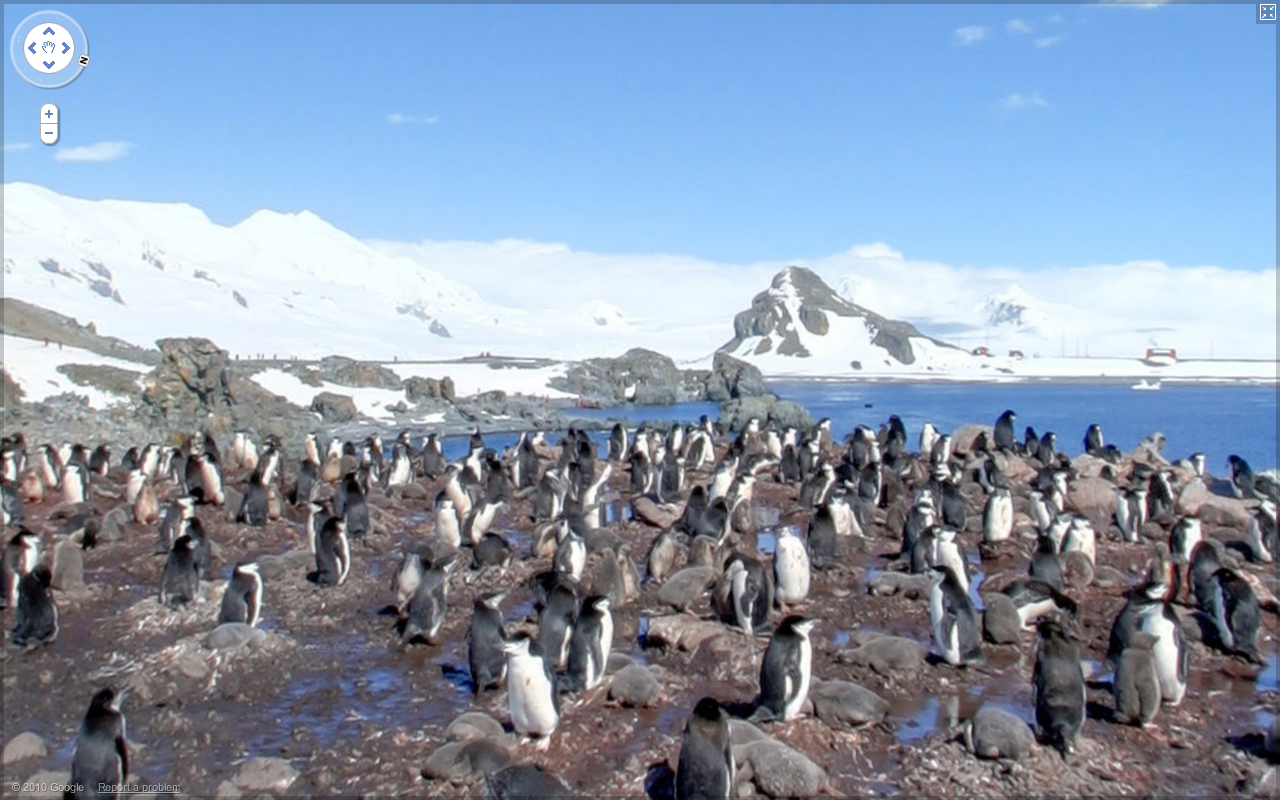
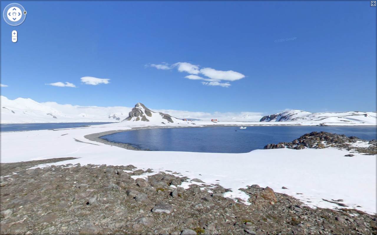
To clarify, the Street View imagery for Antarctica includes panoramas of an area called Half Moon Island – such as this view of penguins and this one of the landscape. The blue dots you see throughout the continent when dragging the pegman are user-contributed photos.

We introduced Street View back in May 2007, enabling people to explore street-level imagery in five U.S. cities. We were excited to share a virtual reflection of the real world to enable armchair exploration. Since then, we’ve expanded our 360-degree panoramic views to many more places, allowing you to check out a restaurant before dining there, to explore a neighborhood before moving there and to find landmarks along the route of your driving directions.

Three years later, we’re happy to announce that you can now explore Street View imagery on all seven continents, with the addition today of Brazil, Ireland and Antarctica. You can now see images from around the world spanning from the beaches of Brazil, to the moors of Ireland, to the icy terrain in Antarctica.

We often consider Street View to be the last zoom layer on the map, and a way to show you what a place looks like as if you were there in person—whether you’re checking out a coffee shop across town or planning a vacation across the globe. We hope this new imagery will help people in Ireland, Brazil, and even the penguins of Antarctica to navigate nearby, as well as enable people around the world to learn more about these areas.

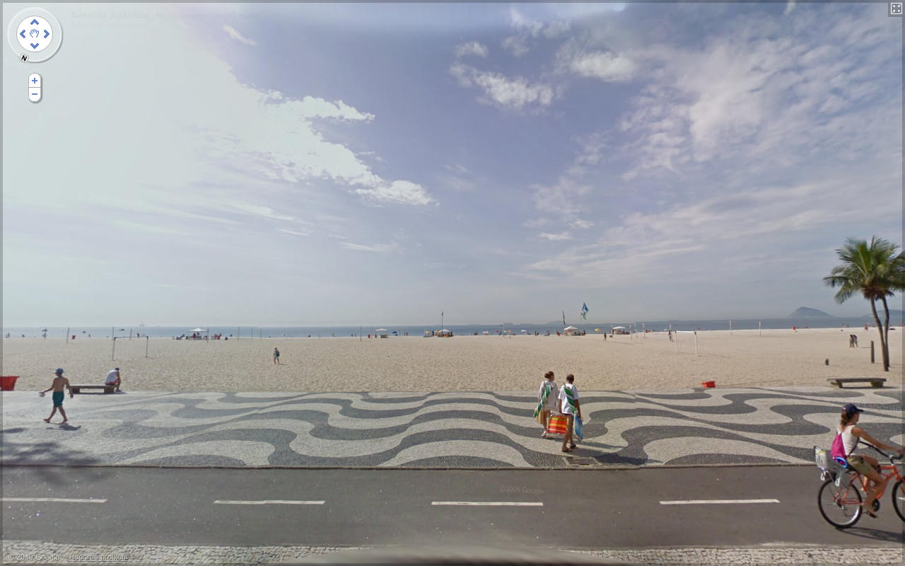
For example, as summer winds down here in Mountain View, Calif., the famous beaches of Copacabana, Brazil are an enticing virtual travel destination.


The Ring of Kerry in Ireland, with its picturesque rolling landscape, is another favorite new place in Street View.


Speaking of travel, my wife BethEllyn and I embarked on the Minerva for an expedition to Antarctica in late January. We enjoyed stunning vistas, and I found that any minute not spent on deck was a spectacular view missed. Fortunately, we’d planned to take some Street View photos, and are now able to share with you the incredible visuals from Half Moon Island, Antarctica.

Here is a group of Chinstrap penguins we saw on the island.


And this is one of my favorite views. You can see part of the crescent shape that gives the island its name.


I’m very proud of the worldwide Street View team and thrilled that everyone can now see places from all seven continents, including the amazing landscapes and natural beauty I saw in Antarctica, through the street-level images in Google Maps and Google Earth. To see more highlights from Street View around the world, visit the Street View gallery and start exploring!

Posted by Brian McClendon, VP of Engineering, Google Earth and Maps

Monday, August 30, 2010

Street View and The Wilderness Downtown


Some of us now live far away from the places where we grew up, and I’ve often found something quite evocative and wistful about looking at photos of the streets where I used to live. A few of us decided to capture this feeling of nostalgia in an interactive music experience that we developed for the web.

The music experience, called “The Wilderness Downtown,” was created by writer/director Chris Milk, with the band Arcade Fire and several of us at Google. Drawing upon Street View in the Google Maps API as well as features made possible by HTML5, we created what we hope is a unique and deeply personal experience of traveling
down the streets where you grew up. All this is set to Arcade Fire’s new song “We Used to Wait” off their newly released album “The Suburbs.”


“The Wilderness Downtown” was made possible by recent developments in modern web technologies and modern browsers, and was built with Google Chrome in mind. As such, it’s best experienced in Chrome or an up-to-date HTML5-compliant browser.

You can launch the project and learn more about it on our Chrome Experiments site at www.chromeexperiments.com/arcadefire. Enjoy the trip down memory lane!

Posted by Aaron Koblin, Google Creative Lab

Thursday, July 8, 2010

Street View driving update

(cross-posted from the Google European Public Policy Blog)

In May we announced that we had mistakenly included code in our software in Street View cars that collected WiFi payload data. As soon as we discovered our error, we not only stopped collecting WiFi data entirely, but also grounded our fleet of cars globally to give us time to remove the WiFi scanning equipment and discuss what had happened with local regulators.

The WiFi data collection equipment has been removed from our cars in
each country and the independent security experts Stroz Friedberg have
approved a protocol to ensure any WiFi-related software is also
removed from the cars before they start driving again. *

Having spoken to the relevant regulators we have decided to start
Street View driving in Ireland, Norway, South Africa and Sweden again
starting next week. We expect to add more countries in time. Our cars
will no longer collect any WiFi information at all, but will continue
to collect photos and 3D imagery as they did before:

  • Photos: so that we can build Street View, our 360 degree street level maps. Photos like these are also being taken by TeleAtlas and NavTeq for Bing maps. In addition, we use this imagery to improve the quality of our maps, for example by using shop, street and traffic signs to refine our local business listings and travel directions; and
  • 3-D building imagery: we collect 3D geometry data with low power lasers (similar to those used in retail scanners) which help us improve our maps. NavTeq also collects this information in partnership with Bing. As does TeleAtlas.
We recognize that serious mistakes were made in the collection of WiFi payload data, and we have worked to quickly rectify them. However we also believe that Street View is a great product for users, whether people want to find a hotel, check out a potential new home or find a restaurant. If you want more information about driving schedules, please look here http://maps.google.com/streetview.

*We've updated this paragraph to clarify that both the hardware and
software will have been removed from all Street View vehicles before they
resume driving.


Wednesday, June 9, 2010

Seeing new sights with photo overlays


Sometimes you want to explore a place for yourself, and sometimes you want to get a sense of how other people experience it. With our newest update to User Photos available within Street View, you can seamlessly do both. Now when you’re browsing a location in Street View, you can see user-contributed photographs directly overlaid within the panorama.


The new feature places thumbnails of relevant photos on top of the Street View imagery when you click the “Photos” option at the top right of the panorama. When you move your mouse cursor over one of these thumbnails, a photo appears which matches the content of the panoramic view. Using the overlays you can quickly preview several photos without changing your viewpoint or losing track of where you were. And if you click on the photo, you enter our interactive photo browser to explore additional pictures taken by the community.

It is now even easier to inspect architectural details and close-up quirks, or see what is happening at a place at more than one time of the day. Start to explore this new world through the eyes of other travelers with some of these locations:

See the Bundesplatz fountains in action

Explore Ponte Vecchio in Florence from a new perspective

See the sun rise over Notre Dame

Tuesday, June 8, 2010

Street View brings a taste of South Africa to football fans everywhere


It’s not every day that you find an elephant in Street View, or for that matter get to visit most of the South African football (or you may know it better as soccer) stadiums in one day. But from today you can do both with our bumper set of brand new Street View images and 3D models of host nation South Africa.

With just days to go before the tournament kicks off, football fans can start soaking up the atmosphere in seven of South Africa’s soccer stadiums, including Soccer City in Johannesburg, Peter Mokaba Stadium in Polokwane and Moses Mabhida Stadium in Durban. Thanks to some serious pedal-power by our trike riders in South Africa we’ve made available these pitch-level pictures from inside and outside of these stadiums. And we’ve created complete 3D models of all 10 stadiums, as well as many host cities which can be viewed in Google Earth -- check them out on the SketchUp Blog.

To make it easier for people to find all these great places South African Tourism have provided information on the most important sights. Visit maps.google.com/exploresouthafrica to start virtually exploring South Africa. Here are some amazing shots from on the field to get you excited:

Moses Mabdhiba Stadium:

View Larger Map

Soccer City Stadium:

View Larger Map

You can view more photos from inside the stadiums in our Street View gallery. But for those who can’t tell their keeper from their striker we’ve got something altogether different. There’s dramatic coastal scenery in the Cape; the urban buzz of Soweto, home to Nelson Mandela; or the world renowned Kruger National Park to explore at your leisure.

In fact, you’ll be greeted by a special host when you start exploring the imagery of Kruger:

View Larger Map

And this coastal view lets you see the sea, as well as Table Mountain in the distance:

View Larger Map

Whatever colours you’ll be wearing when the whistle blows and whichever side you’ll be cheering for in the dreaded penalty shoot out, you can now get a sense for how it might feel for the players to step out onto the turf to take part in the most famous football/soccer tournament in the world!

Monday, April 26, 2010

Browse local businesses in Street View


It probably comes as no surprise that I spend a lot of time using Street View - it’s my job, after all. But sometimes I get so immersed in my exploration that I take all sorts of detours and side trips and find myself in completely unfamiliar areas that I want to learn more about. I have a feeling many of you are also interested in having a better way to find out more about what you’re seeing in Street View, so I’ve been working with my teammates to help improve the discoverability of content in Street View.

Our new release of local businesses annotations in Street View is the first step down this path. Browse around in your neighborhood for nearby restaurants and shops, or use it to see what else is nearby your dinner spot (you can usually catch me looking around for tasty dessert options). When you’re touring in Street View and see a business that piques your itnerest, now you can find a clickable icon that will take you to the business listing where you can find out the name, hours, read reviews, and more.


For now, browsing a location in Street View will show the top listings for that immediate area. We will be extending this coverage soon to include more businesses and also transit locations.

Don’t forget, if you see a business annotation which is not quite aligned with its location in Street View, you can easily move the marker and place it in its correct location.

The weather in San Francisco is supposed to be great tonight, so I think I’m going to start searching for a dessert spot with nice outdoor seating.

Friday, March 19, 2010

This green and pleasant land...


Last week, we announced several new locations added to Street View, along with existing areas updated. One area updated significantly was the United Kingdom. World renowned for its history, rolling green hills and quaint picturesque villages, the UK (although not abundant with dramatic mountainous scenery one see may elsewhere), there are nonetheless many different sights to see. As a UK citizen, I thoroughly enjoyed exploring my home country and want to share with you some places outside the usual tourist belt... and of course some quirky scenes too!

Firstly, going all the way back to the year AD 122, Hadrian's wall is a UNESCO World Heritage Site built by the Roman empire. Parts of the wall are still intact, and each year thousands of people flock to walk sections of the route. Now, you can too without having to worry about getting wet (the UK is famous for its rain for a reason, after all):


View Larger Map

Synonymous with many great examples of English literature, particularly poetry, the Lake District is a showcase of English countryside. Green pastures rise high to form beautifully sculptured valleys with lakes nestling in between. It's easy to see how poets such as William Wordsworth felt inspired when surrounded by scenes like this:


View Larger Map

One form of building construction I am particularly fond of, used in many parts of the UK, is 'thatching'. Using different grasses, primarily straw, these roofs create very attractive buildings and often form the basis of the 'picture postcard' views in areas such as in the Cotswolds. This view below from the Isle of Wight is a classic example of thatching in use to make this quaint English villages scene.


View Larger Map

In 2008, the city of Liverpool was joint holder of the European Capital of Culture. Well known as the birth place of the Beatles, Liverpool is currently undergoing significant regeneration. Outside China, Liverpool is home to one of the largest and oldest Chinese communities, and this image below shows the entrance to Chinatown:


View Larger Map

Belfast, the capital city of Northern Ireland has a long and fascinating history. In recent years, the city has enjoyed much growth and continues to be a popular tourist destination. If it's not up next on your own travel agenda, you can tour through Street View. I suggest visiting Belfast City Hall -- built over a century ago, the hall now stands out as an excellent example of Baroque revival architecture.


View Larger Map

One of the most distinguished cities in the UK and known for its very distinctive architecture, Bath was added to the list of World Heritage Sites in the late 1980s. Established as a spa town by the Romans, Bath is visited each year by millions of people eager to capture the image of rows of houses built from the aptly named Bath Stone:

View Larger Map

Along with these historic and picturesque settings that you'd probably expect from the UK, there are also plenty of amusing things to find through Street View. If you're a fan of long, funny words (like I happen to be), you must visit Llanfairpwllgwyngyllgogerychwyrndrobwllllantysiliogogogoch in Wales, with one of the world's longest placenames. Here the image shows the place name written on a business in the town centre.

View Larger Map

You may not expect our Street View drivers to also serve occasionally as wildlife photographers, but that seems to be what happened with this "Bird View":

View Larger Map

And sometimes we stumble across things that we just can't explain:

View Larger Map

Now if that small selection of oddities has your brain considering what else might be lurking out there, perhaps it's time to visit Loch Ness. With Urquhart Castle in the foreground, maybe Nessie is out there somewhere. You be the judge:

View Larger Map

I hope you have enjoyed my guided Street View tour of the United Kingdom. I wonder what else you can find?